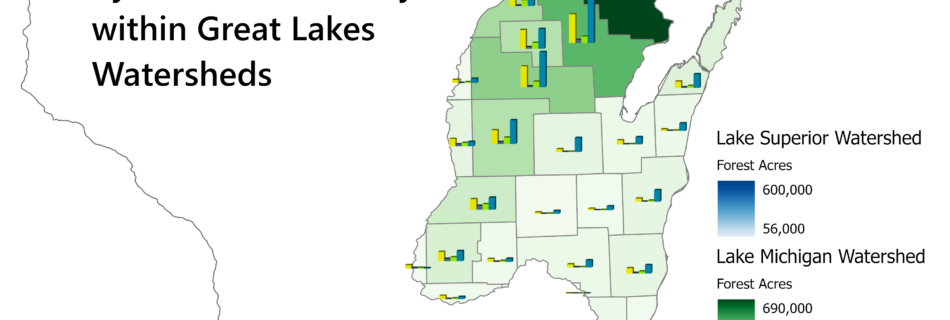
WI Forests in the Great Lakes Watersheds
The 4 classes of forest in NLCD Landcover raster data calculated by county and watersheds presented in a choropleth map with bar charts for an extra layer of detail.
A portfolio type for featuring items in your portfolio.
The 4 classes of forest in NLCD Landcover raster data calculated by county and watersheds presented in a choropleth map with bar charts for an extra layer of detail.
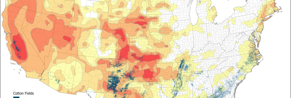
Over half of the US cropland was in drought in 2022. It was a particularly difficult year for cotton crops. Read more about how the 2022 drought affected agriculture in this StoryMap.
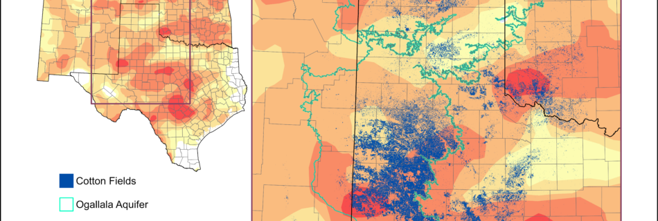
Over half of the US cropland was in drought in 2022. It was a particularly difficult year for cotton crops. Read more about how the 2022 drought affected agriculture in this StoryMap.