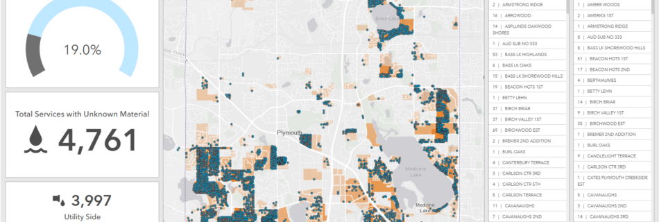
This Dashboard shows the subdivisions that have water service lines of as yet unknown material, from the Lead Service Line Inventory. It uses custom Arcade expressions to create the lists and pop-ups. I wrote a Python script to keep the total “unknowns” by subdivision updated, so the transparency of the subdivision polygons would automatically update.
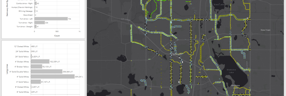
A Dashboard to view and quantify pavement markings. This dashboard is used to help with bidding re-painting the pavement markings.
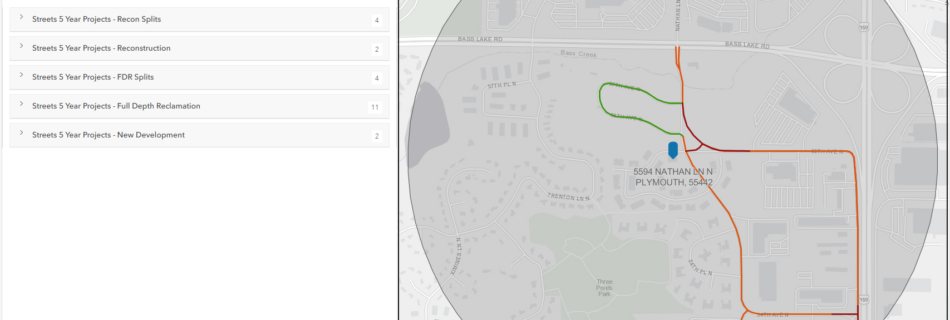
This is a simple Instant App to search by address, to see if it is on a street with new pavement; there is a moratorium on the use of heavy equipment for 5 years on new pavement.
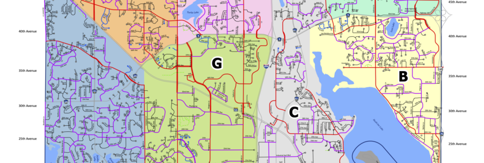
For snow plowing routes, a full-city map to show zone locations when 8 trucks are used. I created 7 full-city maps and 5 map series for 96 total pdf maps. One page of the 8 route map series with one zone per page. Different numbers of trucks are used for different snowfall amounts.
Two pages from a map series I created showing storm, sanitary utilities and surface water basins along a railroad line in the city, to show where culverts cross the railroad.
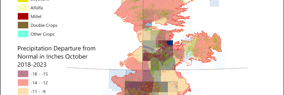
To read more on the High Plains aquifer and cropland, see the Irrigated Crops on the US High Plains StoryMap.
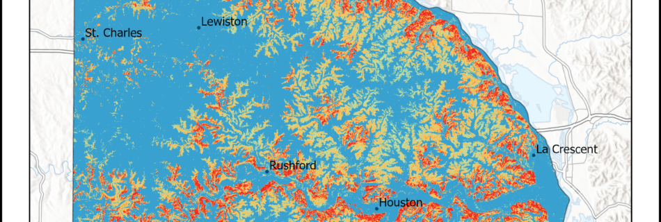
This map is the conclusion to the Japanese Barberry Invasion in SE Minnesota StoryMap.
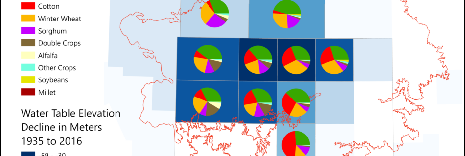
To read more on the High Plains aquifer and cropland, see the Irrigated Crops on the US High Plains StoryMap.
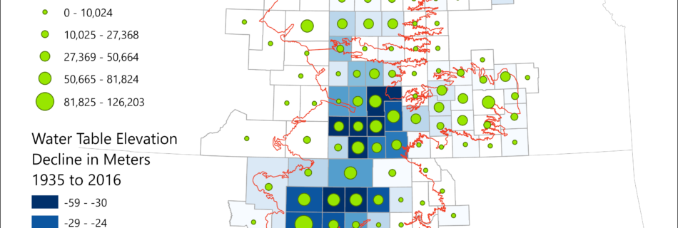
To read more on the High Plains aquifer and cropland, see the Irrigated Crops on the US High Plains StoryMap.
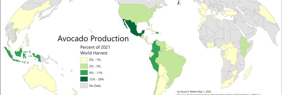
In 2022, the US temporarily blocked all imports of avocados from Mexico after a verbal threat was made to U.S. safety inspectors working in the country. Mexico supplies about 80 percent of the avocados eaten in the United States. I was curious which other countries grow a large volume of avocados, and where else the …
Read more “World Avocado Harvest”